Summary. The main objective of this work is to analyze the behavior of structures Geological Structures composed of the intercalation of shales and sandstones that form the slopes located in the El Playon sector of the state of Mérida. A methodology is applied where Conducts field and laboratory work by first obtaining soil and rock samples to then analyze them with density and simple compression tests, obtaining modulus of Young and Poisson's relationship. With the data obtained, the geomechanical simulation is carried out using geometries based on geological and topographic maps. The Results show the values of deformations, displacements, and stresses between layers sandstones and shales are analyzed. The medium is characterized by quantifying the values of the effects of lithostatic loads where vehicular load was included that the slopes analyzed are part of the cut for Branch 07. The results show that the main minimum deformations occur in the sandstone strata with values of 1.04E-6 and the shales present the highest stress with 1.05E4 MPa. Commuting Larger overall slopes correspond to 4.08 cm on the total slope. The conclusions indicate that the values obtained with numerical analysis match the problems currently encountered in the sector related to mass movements, generating different degrees of susceptibility related to rockfalls and landslides.
Published in: Engineering and Applied Sciences: Mathematical and Computational Models. ISBN 978-980-7161-04-6
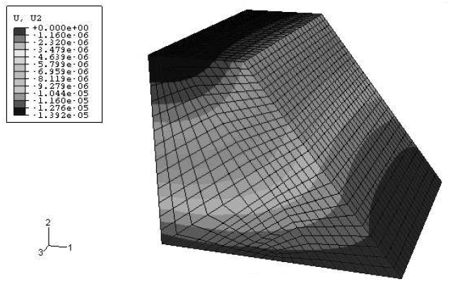
Summary. The Finite Element Method is often widely used in engineering practice due to its power to analyze complex domains in both two and three dimensions, thus becoming an alternative for the study of the behavior of bodies and objects; therefore, it is used in this research, which is oriented towards the geomechanical analysis of the slopes between the populations of San Juan de Lagunillas and Lagunillas in the Sucre Municipality of the State of Mérida, an area made up of poorly consolidated sediments that have experienced small mass movements causing damage to the access roads. The methodology used is developed through four stages: the first consists of the bibliographic review and analysis of aerial photographs; the second is based on field reconnaissance and collection of soil samples, in the third stage the aforementioned samples are tested in the laboratory; obtaining parameters such as Density, Young's modulus and Poisson's coefficient; and the last stage corresponds to the geomechanical simulation, in which the data obtained are processed through the ABAQUSTM computer program (license from the Scientific Calculation Center of the ULA) to know the stresses, deformations and displacements experienced by the slopes due to body forces. In this work, 5 slopes are simulated in 2 dimensions and the influence of the northern trace of the Bocono Fault on one of them is studied, due to the proximity of this fault. The results obtained show stresses in the range of 8E4 Pa to 9E6 Pa, deformations between 7E-6 and 8E-5, occurring only in the elastic range, and displacements with values of 0.598 cm to 12.39 cm, which is indicative of relatively stable slopes. For an imposed stress of 100 KPa at the fault zone, the Model 1 exhibits displacements of approximately 5 to 9 cm.
Published in: Engineering and Applied Sciences: Mathematical and Computational Models. ISBN 978-980-7161-04-6

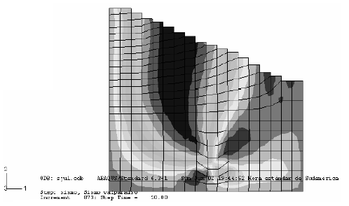
Summary. The main objective of this research is to analyze the local conditions in the seismic responses of the slopes located in the Barrio San José de las Flores and in the Faculty of Medicine, in Mérida, Venezuela. The methodology followed in this work is based on the collection of soil samples to be analyzed by means of laboratory tests and determine the physical parameters of the soil in conjunction with the geometry and characteristics of the slopes. For the determination of the influence of the seismic response, Using the Finite Element Method, the behavior of soils under the effect of the of an earthquake. The results indicate that the soil in the studied areas amplifies the seismic effect in certain locations and high hazard sections are established. Both Slopes have displacements of close to 30 cm in the most vulnerable areas. The main conclusions are that geomechanical simulation makes it possible to obtain, differentiate and quantify the areas affected by the earthquake. The soil analyzed is very sensitive to the action of an intense vibration would therefore the human settlements that are located there would suffer serious damage, such as significant cracks in buildings, landslides, and
hence loss of human life.
Published in: Computational Models in Engineering. ISBN 978-980-7161-02-2
Summary. Plate tectonics, as it is currently conceived, is a theory that explains the main geological characteristics of the planet based on phenomena such as the subduction, the passage and expansion of the ocean floor, this motive gives it a transcendental importance to this theory, which is why it is essential to understand the interaction and phenomena that occur at the boundaries of tectonic plates. In this the aim of this research is to perform a numerical analysis of the boundaries of the Eurasian plates. Philippine and Australian, specifically the state of efforts and displacements using the Finite element method. For this purpose, three-dimensional elastic models are defined where two adjacent plates interact and finally a three-dimensional model is made where It shows the interaction between the three plates mentioned. You get that the greatest efforts They occur in the contact zones between the plates, since this is the area of greatest activity geotectonic. It is very significant that, when carrying out the simulation with the three plates, better results are achieved than in those that consider only two plates, such as Consequently, in this model, a greater number of variables and correspondence are considered. with the real world, it increases significantly.
Published in: Computational Models in Engineering. ISBN 978-980-7161-02-2
Summary. The main objective of this research is to carry out the analysis of the state of the stress-deformation at the contact between the Eurasian, Hindu, and Arabian tectonic plates, through the application of the Finite Element Method. The methodology used is based on a preliminary investigation of the entire bibliographic information needed to construct the three-dimensional numerical models of tectonic plates under study, using calibration models that allow Optimize and maintain the actual conditions of the environment. The results obtained show a Distribution of vertical displacements corresponding to average values of the heights of the Himalayan Mountain range, which were the product of the upheaval due to the convergence between the Hindu and Arabian plates with the Eurasian plate. You also get the Formation of the subduction plane characteristic of the zone in all the models studied. The Numerical modeling performed in this study reproduces the geological behavior of the convergent margin of the plates involved, allowing the formation of the plate to be reconstructed and the quantitative determination of stress and deformation that gave rise to it.
Published in: Computational Models in Engineering. ISBN 978-980-7161-02-2

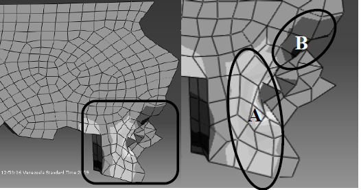
Summary. This research has as main objective to analyze the geological safety of the sector located at the La Blanca Bridge, Mérida State, through simulation by the Finite Element Method. The methodology followed in this paper begins with documentary research and a photogeological study, followed by sampling, which are tested to obtain the geomechanical properties of the rocks and based on this, can performed the simulations, using the ABAQUSTM. Finally, a sectorization of the study area was carried out, to discriminate the subsectors based on its geological safety. The geometries used in the models are generated in field and material characteristics are obtained from laboratory analysis to be used in the simulation with the ABAQUS™ program. Once the conditions to be simulated have been simulated, the study area, responses were obtained based on efforts. displacements and deformations, determining that the area where the Bridge is located La Blanca has intermediate levels of geological security and the presence of the Chama River It greatly affects the area with consequences of pillar undermining and wear. Subsequently, conclusions were drawn regarding the influence of the geological environment on the Safety of the sector under study.
Published in: Computational Models in Engineering. ISBN 978-980-7161-02-2

Summary. The Jose Antonio Páez Hydroelectric Complex is in the state of Mérida in Venezuela and is one of the most representative civil works in western Venezuela, which consists of an arch dam whose reservoir contains more than 3 million liters of water from the Santo Domingo and Aracay rivers. This dam is a very slender structure, with a curved plan and section, transmitting the thrust of the water towards its foundation and its lateral supports with interaction on the slopes that close the gorge of the reservoir. This research analyzes the geomechanical interaction between the body of the dam and its supports located in a gneiss-type rock massif where stresses, deformations and displacements are studied. The methodology applied is based on in situ sampling followed by laboratory tests to obtain the geological constants for the modelling and simulation of the slopes under the loads produced by the water and transmitted by the dam. The results obtained show that the effect of hydraulic thrust on the slopes produces deformations that are within the elasticity ranges, but in some sectors close to plastic limits, the displacements are small, and the maximum forces exerted are located in the typical distributions of the behavior of a structural arc, with high values without causing permanent deformations or considerable displacements.
Published in: Advances in Computational Simulation and Numerical Modeling. ISBN 978-980-7161-03-9

Summary. The main objective of this applied research is to numerically analyze the orogenesis of the Himalayas, applying the Finite Element Method through the ABAQUSTM computational package. The methodology used is initially based on the investigation of topics related to the research, followed by the numerical analysis stage that includes the input data of the model such as: geometry, material properties, edge conditions, acting loads and meshing. The geometry of the Eurasian, Indian and Arabian tectonic plates is obtained through satellite images, which are fundamental for the creation of the model, which is considered up to 100 kilometers deep, composed of lithosphere, whose acting loads and boundary conditions are established based on the geological characteristics of the convergent boundary between the Eurasian-Indian and Eurasian-Arabian plates. The graph of convergence of the model and calibration of the meshing shows that the value obtained for the geonumeric variable U₃ is appropriate, achieving its convergence for 600 elements. On the other hand, in the distribution of U₃ displacements, it is observed that the maximum value reached was 5660 meters, which is close to the average values of the height of the Himalayan Mountain range (6000 meters). This distribution and quantification of U₃ displacements, together with the comparative analysis, allow us to emulate the origin of the most imposing mountain range on our planet, the Himalayas.
Published in: Advances in Computational Simulation and Numerical Modeling. ISBN 978-980-7161-03-9

Summary. In Venezuela, the state of Miranda has a very particular topography that includes high elevations and depressions, which favor landslides and landslides. Even in your area the population has been affected by flooding, which constantly forces them to leave their homes. households. The main objective of this research is to apply the finite element method in the Two-dimensional geomechanical simulation representing the existing hazards in outcrops located in the north of the state. The behavior of rocks and soils present in the area is studied quantifying geological and geomechanical parameters that allow the analysis of the natural risk of the sector, and therefore, to reduce the negative consequences in areas of urban development. The methodology The use of the project was based on selecting those areas with the greatest danger and vulnerability, collecting representative samples and obtaining their characteristic values in the laboratory. Numerical simulation shows how the disposition of schistosity and slope influence outcrops, obtaining displacements and deformations that exceed the safety limits, considering areas of high danger due to being located on clay soils that create a large area of weakness that It generates mass landslide of soil and buildings, which is quantified in the analysis.
Published in: Computational Models in Engineering. ISBN 978-980-7161-02-2

Summary. The main objective of this research is to simulate numerically the interactions of convergent boundaries between South American and Nazca plates, to analyze the unitary elastic deformation energy in the subduction zone and its effect on the uplift of Los Andes. The methodology is divided in two stages; the one corresponds to the selection of geological constants for the simulation and the creation of the geometries of the models based on local coordinates, and in the second stage the models are simulated numerically using the finite element method. The results show the energy fields of deformation and its relationship with the displacement values obtained with errors less than 2% in the altitudes of the mountains and 0% in the plains of central Chile. The distribution of strain energy in each model has a periodical behavior with peaks and releases that affect the movement. The main conclusions indicate that the numerical simulation reproduces accurately the effects on the edge of the tectonic plates studied, making possible to quantify and qualify the energy of deformation and its effects.
Published in: Revista Ciencia e Ingeniería. ISSN 2244-8780

